MAKE A MEME
View Large Image
| View Original: | Chile_Araucania_Map_1610.jpg (2505x555) | |||
| Download: | Original | Medium | Small | Thumb |
| Courtesy of: | commons.wikimedia.org | More Like This | ||
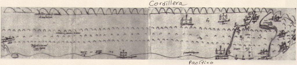
| Keywords: Chile Araucania Map 1610.jpg Arauko-Krieg zerstörten Ansiedlungen durchgestrichene Siedlungssymbole ganz rechts Abgedruckt in Ricardo Padrón The Spacious World Cartography Literature and Empire in the Early Modern Spain University of Chicago Press 2004 S 81 Fig 22 Arauco War a long-running conflict between colonial Spaniards and the Mapuche people fought in the Araucanía Published in Ricardo Padrón The Spacious World Cartography Literature and Empire in the Early Modern Spain University of Chicago Press 2004 p 81 fig 22 guerra de Araucanía por los Mapuche símbolos tachados a la derecha y fue redactado en 1610 como parte de un informe sobre el estado de la supresión de la rebelión indígena en el Sur de Chile Publicado en Ricardo Padrón The Spacious World Cartography Literature and Empire in the Early Modern Spain University of Chicago Press 2004 pág 81 fig 22 Archivo General de Indias Madrid author 1610 Maps showing history Araucanía Region Arauco War Maps of the history of Chile Mapuche maps Maps of the Spanish Empire Old maps of Chile PD-old-100 | ||||