MAKE A MEME
View Large Image
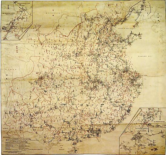
| View Original: | China_Map_Postal_1903.jpg (822x768) | |||
| Download: | Original | Medium | Small | Thumb |
| Courtesy of: | commons.wikimedia.org | More Like This | ||
| Keywords: China Map Postal 1903.jpg zh ć€§æž é”æżć ŹçœČćçšèŒżć ïŒ101 7Ă96 5é米ïŒć Źć 1903ćčŽïŒæž ć ç»Șäșćäč ćčŽïŒćșçă ć çäŸæșïŒhttp //geog hkbu edu hk/GEOG1150/Chinese/Catalog/am52 htm éŠæžŻæ”žæ 性ćžć °ççł»äžć ć€ć °ć ă æ Źć æŻäžè±ć°ç §ïŒé»çŽ ć ©èČć„ć°ïŒèĄšç€șæž æ ć ç·ćčŽéć šć é”æżç æłçć°éĄć °ć ă æšæ ç æ ă ćș ă ć·ă 瞣çèĄæżćźäœïŒäșŠććäșé”æżć °ć ïŒæšç€ș濫俥é”è·Żćé»ć ±ć± ććžă ćéĄèŠçŽ çèĄšç€șć 仄珊èćă PD-old 20th-century maps of China China in the 1900s | ||||