MAKE A MEME
View Large Image

| View Original: | Contour map of Gulf of Mexico 1888.jpg (700x462) | |||
| Download: | Original | Medium | Small | Thumb |
| Courtesy of: | commons.wikimedia.org | More Like This | ||
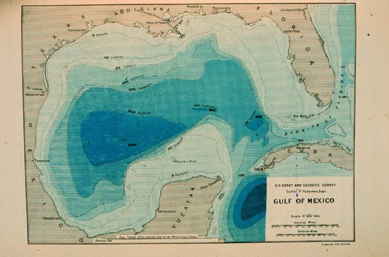
| Keywords: Contour map of Gulf of Mexico 1888.jpg Contour map of Gulf of Mexico as sounded by the C GS Steamer BLAKE between 1873 and 1875 Over 3 000 soundings went into this chart most of the deep water soundings beween taken by the Sigsbee Sounding Machine This was the first realistic bathymetric map of any oceanic basin In Three Cruises of the BLAKE by Alexander Agassiz 1888 P 102 NOAA Central Library Image ID theb3785 Voyage To Inner Space - Exploring the Seas With NOAA http //www photolib noaa gov/htmls/theb3785 htm 1888 U S Coast and Geodetic Survey PD-USGov Original upload log en wikipedia Contour+map+of+Gulf+of+Mexico+1888 jpg wikitable - 2012-02-10 19 48 700×462× 140294 bytes Palmeira Contour map of Gulf of Mexico as sounded by the C GS Steamer BLAKE between 1873 and 1875 Over 3 000 soundings went into this chart most of the deep water soundings beween taken by the Sigsbee Sounding Machine This was t Uncategorized 2016 May 6 | ||||