MAKE A MEME
View Large Image
| View Original: | Dalriada.jpg (509x531) | |||
| Download: | Original | Medium | Small | Thumb |
| Courtesy of: | commons.wikimedia.org | More Like This | ||
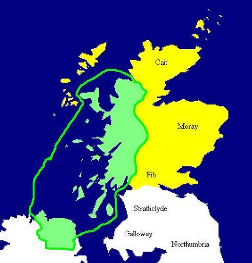
| Keywords: Dalriada.jpg Extent of the Kingdom of Dál Riata in green c AD 590 Yellow areas show occupation by the Picts Mapa de Dalriada hacia el año 590 Las regiones pictas están marcadas en amarillo Copied from en Image Dalriada jpg en User Briangotts badJPEG map Briangotts Maps of the history of Scotland | ||||