MAKE A MEME
View Large Image

| View Original: | Dengue06.png (1161x631) | |||
| Download: | Original | Medium | Small | Thumb |
| Courtesy of: | commons.wikimedia.org | More Like This | ||
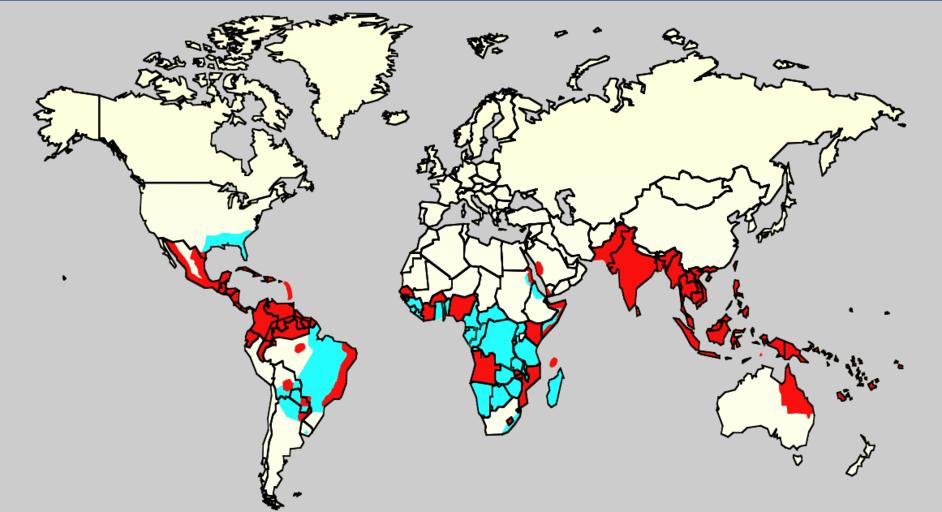
| Keywords: Dengue06.png health map en Map showing the distribution of dengue fever in the world as of 2006 Map produced by the Agricultural Research Service of the US Department of Agriculture Slide 8 of a presentation by Gary G Clark PhD entitled Dengue An emerging arboviral disease Cyan Areas infested with Aedes aegypti Red Areas with Aedes aegypti and recent epidemic dengue fever Referencias Celeste http //www afpmb org/meetings/TriService2007/Presentations/ Monday/OClubMorning/TRIServiceDENemergingJAX2007 ppt Áreas infectadas con el mosquito Aedes aegyptis Rojo Áreas que estan infectadas con el mosquito Aedes Aegyptis y que tienen una reciente expansión epidémica author PD-USGov Dengue maps Disease incidence world maps | ||||