MAKE A MEME
View Large Image
| View Original: | Diego_Garcia_Island_Map.jpg (888x1240) | |||
| Download: | Original | Medium | Small | Thumb |
| Courtesy of: | commons.wikimedia.org | More Like This | ||
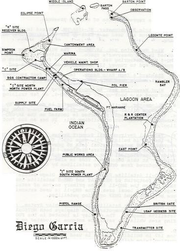
| Keywords: Diego Garcia Island Map.jpg en Diego Garcia Island Map from around 2002 This is FIGURE 2 Diego Garcia Island Map from the source document 'Local Area Forecaster's Handbook for Diego Garcia' 2002-04-05 http //www globalsecurity org/military/library/report/2002/diego-fdo-handbook doc NAVCENTMETOCDETDGINST 3140 2 05 APR 2002 US Navy Naval Central Meteorology and Oceanography Detachment Diego Garcia other versions PD-USGov-Military-Navy Maps of the British Indian Ocean Territory Diego Garcia | ||||