MAKE A MEME
View Large Image

| View Original: | Edinburgh_in_the_17thC_(detail)_by_Wenceslas_Hollar_(1670).jpg (2033x1215) | |||
| Download: | Original | Medium | Small | Thumb |
| Courtesy of: | commons.wikimedia.org | More Like This | ||
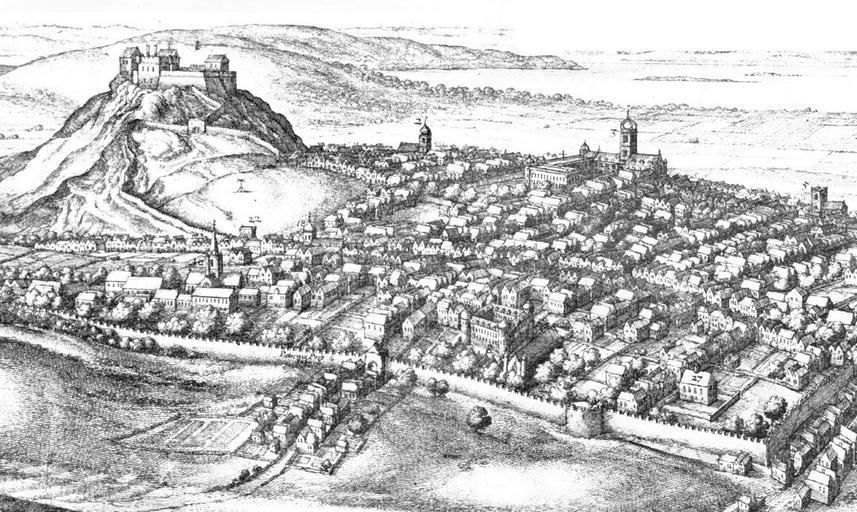
| Keywords: Edinburgh in the 17thC (detail) by Wenceslas Hollar (1670).jpg page at Commons 2011-11-25 Scanned from an old book print Wenceslas Hollar PD-old-100 Old maps of Edinburgh History of Edinburgh Historical images of Edinburgh Scotland in the 17th century ImageNote 1 244 71 346 186 2033 1215 2 Edinburgh Castle ImageNoteEnd 1 ImageNote 2 925 269 127 112 2033 1215 2 Weigh House ImageNoteEnd 2 ImageNote 3 1227 320 188 135 2033 1215 2 Parliament House ImageNoteEnd 3 ImageNote 4 1433 249 163 193 2033 1215 2 St Giles Kirk ImageNoteEnd 4 ImageNote 5 1881 409 145 147 2033 1215 2 Tron Kirk before steeple added ImageNoteEnd 5 ImageNote 6 554 506 79 89 2033 1215 2 West Port ImageNoteEnd 6 ImageNote 7 1080 696 211 170 2033 1215 2 The Tounis College on the site of Kirk o' Field This is the correct position for the College in relation to the Potterrow Port but architecturally this building strongly resembles George Heriot's Hospital rather than the college buildings with a wrongly aligned Grey Friars Kirk to its immediate right If so both have been misplaced east of Potterrow when their true position should be west of it where a steepled church is shown See the Gordon of Rothiemay map of 1647 commissioned by the Town Council for the true positions of these buildings ImageNoteEnd 7 ImageNote 8 844 796 94 130 2033 1215 2 Potterrow Port ImageNoteEnd 8 ImageNote 9 440 524 125 168 2033 1215 2 Grey Friars Kirk But see note on The Tounis College ImageNoteEnd 9 ImageNote 10 1593 854 130 122 2033 1215 2 Surgeons' Hall Curryhill the house of Sir James Skene bought by the Incorporation of Surgeons in 1656 ImageNoteEnd 10 ImageNote 11 1858 1017 173 188 2033 1215 2 The Pleasance ImageNoteEnd 11 ImageNote 12 582 897 262 203 2033 1215 2 Potterrow ImageNoteEnd 12 ImageNote 13 691 498 137 104 2033 1215 2 St Magdalene Chapel ImageNoteEnd 13 ImageNote 14 1233 935 313 109 2033 1215 2 Flodden Wall ImageNoteEnd 14 ImageNote 15 1161 163 244 56 2033 1215 2 Firth of Forth ImageNoteEnd 15 | ||||