MAKE A MEME
View Large Image

| View Original: | Edinburgh_in_the_reign_of_David_II.jpg (1173x1402) | |||
| Download: | Original | Medium | Small | Thumb |
| Courtesy of: | commons.wikimedia.org | More Like This | ||
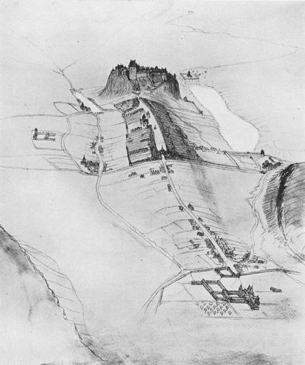
| Keywords: Edinburgh in the reign of David II.jpg Page at Commons 2013-02-13 20 03 11 scanned from Edinburgh 1329-1929 Sexcentenary of Bruce Charter Oliver And Boyd 1929 author Custom license marker 2013 02 13 PD-old-70 Uploaded with UploadWizard Maps of Edinburgh ImageNote 1 686 262 87 56 1173 1402 2 West Kirk ImageNoteEnd 1 ImageNote 2 115 484 108 66 1173 1402 2 Kirk o'Field ImageNoteEnd 2 ImageNote 3 297 587 91 101 1173 1402 2 Blackfriars ImageNoteEnd 3 ImageNote 4 297 384 61 66 1173 1402 2 Greyfriars ImageNoteEnd 4 ImageNote 5 908 1081 105 122 1173 1402 2 Holyrood Abbey ImageNoteEnd 5 ImageNote 6 1000 599 82 82 1173 1402 2 Trinity College Kirk ImageNoteEnd 6 ImageNote 7 602 564 49 56 1173 1402 2 Netherbow Port ImageNoteEnd 7 ImageNote 8 531 433 49 63 1173 1402 2 St Giles' Kirk ImageNoteEnd 8 ImageNote 9 775 337 258 222 1173 1402 2 Nor Loch ImageNoteEnd 9 ImageNote 10 452 405 103 28 1173 1402 2 West Bow ImageNoteEnd 10 ImageNote 11 396 211 288 159 1173 1402 2 Edinburgh Castle ImageNoteEnd 11 ImageNote 13 583 470 33 35 1173 1402 2 Tron ImageNoteEnd 13 ImageNote 14 546 747 323 82 1173 1402 2 Burgh of Canongait ImageNoteEnd 14 ImageNote 15 208 248 59 56 1173 1402 2 Roads to Dumfries Glasgow and Stirling ImageNoteEnd 15 ImageNote 16 482 215 59 105 1173 1402 2 David's Tower ImageNoteEnd 16 ImageNote 17 386 772 105 96 1173 1402 2 Cowgait ImageNoteEnd 17 ImageNote 18 581 510 73 42 1173 1402 2 Hie Gait ImageNoteEnd 18 ImageNote 19 489 602 105 35 1173 1402 2 King's wall ImageNoteEnd 19 | ||||