MAKE A MEME
View Large Image

| View Original: | Eifel_MĂĽnster_,_Sebastian-_Eyfalia_(1550_-_1628)_.JPG (1892x2950) | |||
| Download: | Original | Medium | Small | Thumb |
| Courtesy of: | commons.wikimedia.org | More Like This | ||
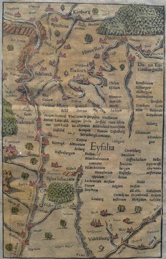
| Keywords: Eifel MĂĽnster , Sebastian- Eyfalia (1550 - 1628) .JPG de Historische Karte der Region links des Mittelrheins mit u a HunsrĂĽck und Eifel aus dem Jahr 1628 nichtkolorierte Erstveröffentlichung 1550 Die Karte ist žgesĂĽdet d h Norden ist unten en Historical map of the region left of the middle reaches of the River Rhine showing the HunsrĂĽck and Eifel mountains and adjacent areas published in 1628 the first uncoloured version was published in 1550 Note that north is to the bottom Cosmographia Heinrich Petri Basel 1628 for full page scan of the http //landkarten-sammeln de/SonderEifel/DW1550001EifelIcon150 JPG cropped image see http //landkarten-sammeln de/Landkarten/DW1550001 htm landkarten-sammeln de Sonderausstellung Die Eifel im Bild alter Landkarten 1550 - 1750 1628 - Sebastian MĂĽnster Die ander Tafel des Rheinstroms begreiffend die Pfaltz Westereich Eyfel etc Sebastian MĂĽnster 1628 PD-old-100 PD-US Eifel MĂĽnster, Sebastian-Eyfalia (1550-1628).jpg de Historische Karte der Region links des Mittelrheins mit u a HunsrĂĽck und Eifel aus dem Jahr 1628 nichtkolorierte Erstveröffentlichung 1550 Die Karte ist žgesĂĽdet d h Norden ist unten en Historical map of the region left of the middle reaches of the River Rhine showing the HunsrĂĽck and Eifel mountains and adjacent areas published in 1628 the first uncoloured version was published in 1550 Note that north is to the bottom Cosmographia Heinrich Petri Basel 1628 for full page scan of the http //landkarten-sammeln de/SonderEifel/DW1550001EifelIcon150 JPG cropped image see http //landkarten-sammeln de/Landkarten/DW1550001 htm landkarten-sammeln de Sonderausstellung Die Eifel im Bild alter Landkarten 1550 - 1750 1628 - Sebastian MĂĽnster Die ander Tafel des Rheinstroms begreiffend die Pfaltz Westereich Eyfel etc Sebastian MĂĽnster 1628 PD-old-100 PD-US Uncategorized 2016 March 10 | ||||