MAKE A MEME
View Large Image
| View Original: | ElizabethCity.jpg (2413x1813) | |||
| Download: | Original | Medium | Small | Thumb |
| Courtesy of: | commons.wikimedia.org | More Like This | ||
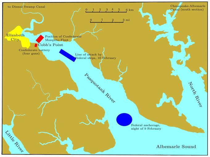
| Keywords: ElizabethCity.jpg en Chart of the Pasquotank River near Elizabeth City NC showing the Confederate defenses and the attacking Federal column of ships at the Battle of Elizabeth City 10 February 1862 Own self 2009-09-20 Hand-traced from a map prepared by the United States Geological Survey not subject to copyright All of my modifications are hereby released into the public domain Maps of Ports and Naval Operations in the American Civil War | ||||