MAKE A MEME
View Large Image
| View Original: | ES Francia 1552-1798.png (975x737) | |||
| Download: | Original | Medium | Small | Thumb |
| Courtesy of: | commons.wikimedia.org | More Like This | ||
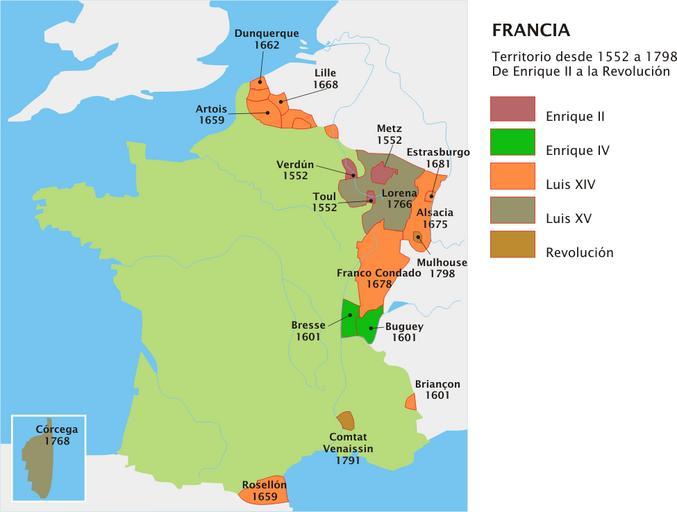
| Keywords: ES Francia 1552-1798.png Mapa evolutivo del territorio francés entre 1552 y 1798 Versión en español Maps of the kingdom of France 1552 Territorial evolution of France 2006-07-16 own assumed Yavidaxiu | ||||