MAKE A MEME
View Large Image

| View Original: | France 40-44.png (3176x2869) | |||
| Download: | Original | Medium | Small | Thumb |
| Courtesy of: | commons.wikimedia.org | More Like This | ||
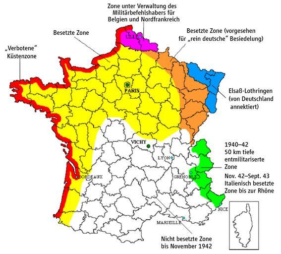
| Keywords: France 40-44.png Map France under German occupation 1940-44 Created by the author adapted from english version of w en User Adam Carr Emmanuel de Chambost France german version by Ziegelbrenner 2009-03-19 This adaptation of map of 1940-44 France created by myself can be used under the GNU Licence Ziegelbrenner 2009-03-19 Axis Occupation of France png France map Lambert-93 with regions and departments-occupation-de svg Kartenwerkstatt Maps of France during Vichy government | ||||