MAKE A MEME
View Large Image
| View Original: | Frankish Foederatus.png (570x471) | |||
| Download: | Original | Medium | Small | Thumb |
| Courtesy of: | commons.wikimedia.org | More Like This | ||
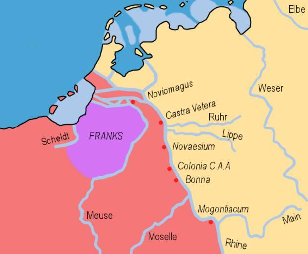
| Keywords: Frankish Foederatus.png en The Frankish Foederati' around 360 A D; based on the maps present at the tacitus nu website; http //www tacitus nu/historical-atlas/francia htm LINK; showing the Frankish expansion own HP1740-B 2009-03-31 Inferior German Limes Germanic languages Maps of the Frankish territory Netherlands in the 4th century Maps of North Brabant Fiefdoms in the Netherlands Germania Inferior Maps of the history of North Rhine-Westphalia Maps of the history of the Rhineland | ||||