MAKE A MEME
View Large Image
| View Original: | Frankish_kingdoms_in_628.jpg (1239x1149) | |||
| Download: | Original | Medium | Small | Thumb |
| Courtesy of: | commons.wikimedia.org | More Like This | ||
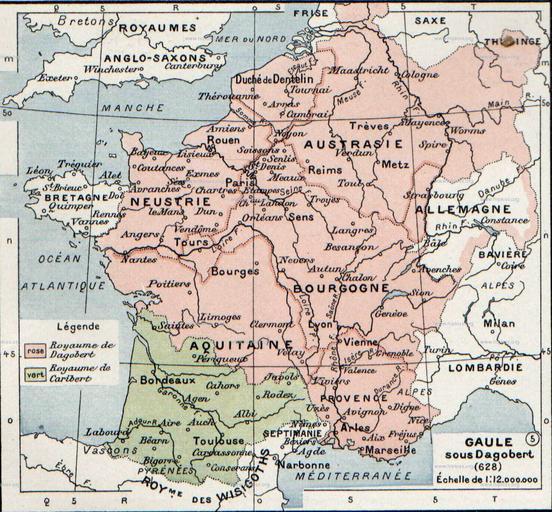
| Keywords: Frankish kingdoms in 628.jpg The map comes from Vidal-Lablache Atlas général d'histoire et de géographie 1894 It shows the Frankish kingdoms in 628 AD Gaule sous Dagobert 628 Paul Vidal de La Blache Atlas général d'histoire et de géographie 1894 Paul Vidal de La Blache Atlas général d'histoire et de géographie 1894 1894 Creator Paul Vidal de La Blache PD-old-auto-1923 1918 Original upload log page en wikipedia Frankish_kingdoms_in_628 jpg 2007-08-19 21 37 Srnec 1239×1149×8 363198 bytes <nowiki>The map comes from Vidal-Lablache Atlas général d'histoire et de géographie 1894 PD-art-life-70 </nowiki> Maps of the Merovingian territory Maps of Gauls Maps showing 7th-century history France in the 7th century Maps in French Paul Vidal de La Blache | ||||