MAKE A MEME
View Large Image
| View Original: | GooseneckMeandersUtahTopo1.jpg (3757x2876) | |||
| Download: | Original | Medium | Small | Thumb |
| Courtesy of: | commons.wikimedia.org | More Like This | ||
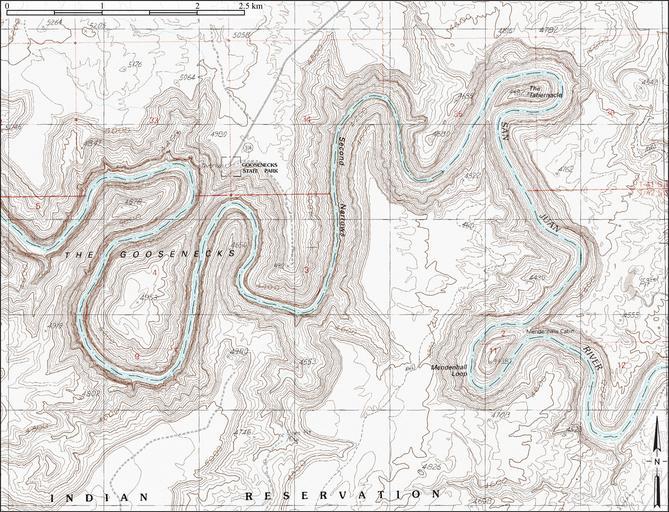
| Keywords: GooseneckMeandersUtahTopo1.jpg entrenched meanders of San Juan River Located within Gooseneck State Park San Juan County Utah - Constructed from county topographic map DRG mosaic for San Juan County from USDA/NRCS - National Cartography Geospatial Center using Global Mapper 12 0 and Adobe Illustrator Contour interval 50 feet Latitude 33° 31' 49 52 N Longitude 111° 37' 48 02 W 2011-05-10 USDA/FSA United States Geological Survey PD-USGov Goosenecks State Park Entrenched meanders Maps of rivers of the Western United States Maps of protected areas of the United States San Juan River Utah | ||||