MAKE A MEME
View Large Image

| View Original: | Grand Canyon Mather Point02.jpg (1680x2520) | |||
| Download: | Original | Medium | Small | Thumb |
| Courtesy of: | commons.wikimedia.org | More Like This | ||
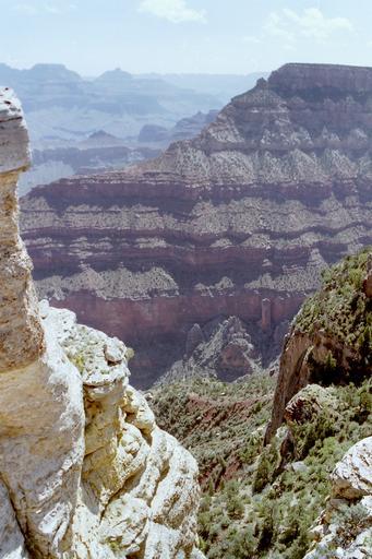
| Keywords: Grand Canyon Mather Point02.jpg Grand Canyon is a steep sided gorge formed by the Colorado River in northern Arizona United States View from Mather Point on the South Rim to the gorge <br> View due northeast overlooking ridgeline north from Yaki Point ~1-mi due-east of Mather The close-up white-buff layered stone cliff at left is flat-topped bedded en Kaibab Limestone/Kaibab Formation The ridgeline in view is extremely steep west side ; the east side contains less steep grade though still exceedingly steep contains the en South Kaibab Trail The usual coloration of the red en Supai Group en red beds is possibly from the lack of 'debris accumulation' and thus the build-up of stains on the rock from overlying rock units minieralization when wet the Supai Group is dramatically darker than typical Grand Canyon exposures The Supai Group 4-units sit on the ~500 ft vertical cliff of Redwall Limestone prominent as one of the base units on many landforms seen along Granite Gorge in the depth of Grand Canyon Grand Canyon ist eine vom Colorado River geformte tiefe Schlucht im nördlichen Arizona Vereinigte Staaten Im Bild Blick vom Mather Point am Südrand in die Schlucht own 1998-05-22 Nikater Own work all rights released Public domain 36 061624 -112 107947 region US_heading 83 estimated camera position ImageNote 1 437 290 172 88 1680 2520 2 Vishnu Temple ImageNoteEnd 1 ImageNote 2 139 265 189 88 1680 2520 2 Wotans Throne ImageNoteEnd 2 Grand Canyon South Rim Mather Point Wotans Throne Walhalla Plateau Mather Point Views from Mather Point Yaki Point Kaibab Limestone bedding Toroweap Formation bedding Coconino Sandstone cliffs Hermit Formation slopes Supai Group Supai Group 'redbeds' Esplanade Sandstone cliffs Wescogame Formation slopes Manakacha Formation bedding Watahomigi Formation slopes Redwall Limestone Redwall Limestone cliffs | ||||