MAKE A MEME
View Large Image

| View Original: | Grenoble_Tassin_1638.jpg (1812x1232) | |||
| Download: | Original | Medium | Small | Thumb |
| Courtesy of: | commons.wikimedia.org | More Like This | ||
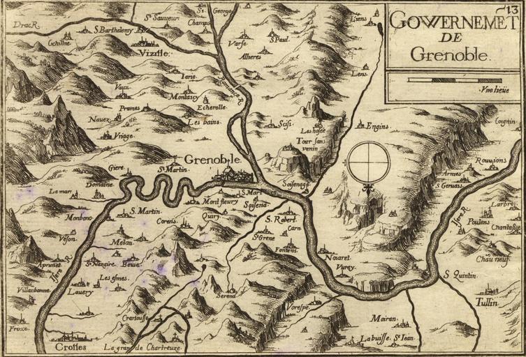
| Keywords: Grenoble Tassin 1638.jpg fr Carte géographique ancienne de la région de Grenoble Isère - Dauphiné - France par Tassin aux alentours de 1638 Il est intéressant de noter l'orientation inhabituelle Sud - Nord de cette carte ainsi que la toponymie très différente de celle d'aujourd'hui Ainsi par exemple Meylan était alors orthographié Mélan A noter l'inversion entre Drac et Romanche en Old map of Grenoble area Dauphiné - Isère - France by Tassin circa 1638 Of interest is the unconventional South-North orientation of this map as well as the different toponomy For example Meylan is shown as Mélan on the map Note that the rivers Drac and Romanche are inverted fr http //www kelibia fr/histoirepostale/x_azdivers htm cartes géographiques anciennes du site histoirepostale net en http //www kelibia fr/histoirepostale/x_azdivers htm old maps from histoirepostale net website 1638 Tassin reproduit par http //histoirepostale net histoirepostale net 45 11 39 3936 N 5 43 53 8824 E PD-old-100 Old maps of Isère Maps of Grenoble Dauphiné Maps of the Rhone watercourse system | ||||