MAKE A MEME
View Large Image
| View Original: | Inini.png (1884x2160) | |||
| Download: | Original | Medium | Small | Thumb |
| Courtesy of: | commons.wikimedia.org | More Like This | ||
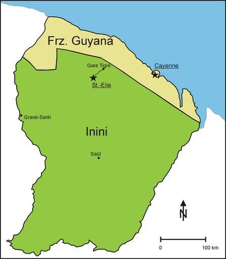
| Keywords: Inini.png en Division of French Guiana from 1930 to 1946 into a coastal strip further called French Guiana and the interior administered as Territoire de l' Inini Inini Territory de Teilung Franz Guyanas von 1930 bis 1946 in einen Küstenstreifen der weiterhin Franz Guyana genannt wurde und das Landesinnere das unter dem Namen Inini verwaltet wurde own source for the northern boundary of Inini http //www waiapi-wayapi-teko org/carte htm Diorit 2011-01-03 Cc-zero Maps of French Guiana | ||||