MAKE A MEME
View Large Image
| View Original: | Jan_Mayen_(1).jpg (1964x676) | |||
| Download: | Original | Medium | Small | Thumb |
| Courtesy of: | commons.wikimedia.org | More Like This | ||
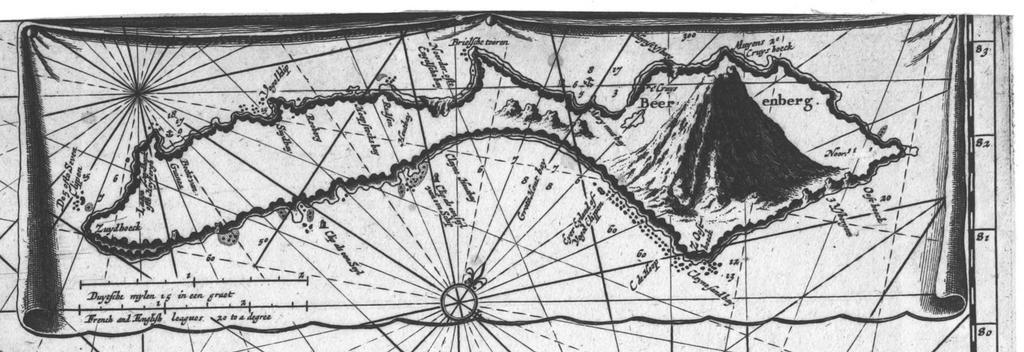
| Keywords: Jan Mayen (1).jpg en Jan Mayen detail insert of a 17th century Dutch map of the North-East Atlantic and Barents Sea The long Dutch name of the map translates more or less as Map of Russia Lapland Finmark Spitsbergen and Nova Zembla checked for news and improved with the river of Archangel Jan Mayen Island and a part of Spitsbergen which are shown very accurately in separate tables inserts in their details at a large scale nl Jan Mayen detail inzet van een 17e eeuwse Nederlandse kaart getiteld Paskaert van Ruslant Laplant Finmarcken Spitsbergen en Nova Zembla op Nieuws oversien en verbeetert met de Rivier van Archangel Ian Mayen Eylant en een gedeelte van Spitsbergen't welckjder in een bysonder Tafeltie met haer opdoeninge in een groot bestek seer naeukeurig vertoont werd ark /12148/btv1b5901027m/f1 Jacobus Robijn 16 -171 Graveur/Engraver 17th century somewhere 1600-1699 Full bibliographic details Author Robijn Jacobus 16 -171 Graveur ; Publisher by Iohannis de Ram Plaetsnyder t'Amsterdam ; Date of publication 1600-1699 ; Type document cartographique carte image fixe ; Language Dutch ; Format 1 carte ill ; 44 x 54 5 cm ; Format image/jpeg ; Copyright domaine public ; Identifier ark /12148/btv1b5901027m ; Source Bibliothèque nationale de France département Cartes et plans CPL GE DD-2987 2872 ; Relation Appartient à Collection d'Anville ; 02872 ; Relation http //catalogue bnf fr/ark /12148/cb40771511d ; Provenance bnf fr PD-old-100 Old maps of the Arctic Maps in Dutch Maps made in the 17th century Old maps of Jan Mayen | ||||
.jpg)