MAKE A MEME
View Large Image
| View Original: | KAARTEN SGD - Mogelijke grenzen van het continentaal plat.jpeg (1289x1787) | |||
| Download: | Original | Medium | Small | Thumb |
| Courtesy of: | commons.wikimedia.org | More Like This | ||
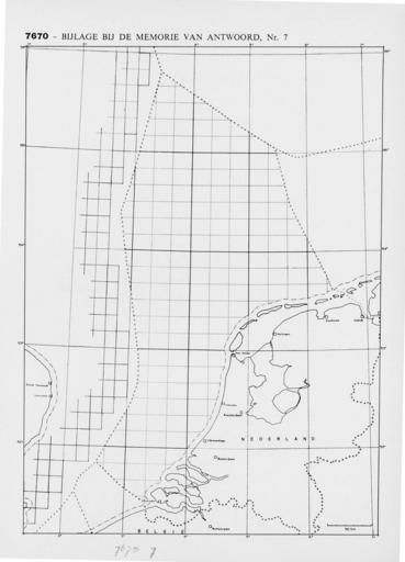
| Keywords: KAARTEN SGD - Mogelijke grenzen van het continentaal plat.jpeg accession number en The individual creators of this map are unknown it was commissioned by the House of Representatives of the Netherlands Behoort bij de Memorie van Antwoord betreffende Regelen ten aanzien van het onderzoek naar en de winning van delfstoffen in of op het onder de Noordzee gelegen deel van het continentaal plat Mijnwet continentaal plat help warp This map was digitized by the Institution Koninklijke Bibliotheek ; Koninklijke Bibliotheek 53 5166666666667 Noordzee 4 16666666666667 map date 1965 landsgrenzen other fields other versions CC0 print date 1965 This map was commissioned and published by the Institution Tweede Kamer ca 1 2 200 000 This image in context http //www statengeneraaldigitaal nl/document id sgd mpeg21 19641965 0001553 pagina 1; Tweede Kamer KAARTEN SGD - Mogelijke grenzen van het continentaal plat wikidata location wikidata title Uploaded with GWToolset KAARTEN SGD - Mogelijke grenzen van het continentaal plat http //resolver kb nl/resolve urn sgd mpeg21 19641965 0001553 0001 image | ||||