MAKE A MEME
View Large Image

| View Original: | Kyoto-Fushimi Railway Line Map.svg (2104x1800) | |||
| Download: | Original | Medium | Small | Thumb |
| Courtesy of: | commons.wikimedia.org | More Like This | ||
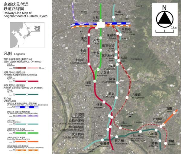
| Keywords: Kyoto-Fushimi Railway Line Map.svg en This is the Railway Line Map of neighborhood of Kyoto Fushimi in Japan This is the vector image version ja õ║¼ķāĮõ╝ÅĶ”ŗõ╗śĶ┐æķēäķüōĶĘ»ńĘÜÕø│Ń éŃāÖŃé»ŃāłŃā½ńö╗ÕāÅńēłŃ é This has a sattelite image based by LANDSAT remote sensing data 2007-05 excl-zoo PD Image Kyoto-Fushimi_Railway_Line_Map jpg<br /> Image Kyoto-Nara_Railway_Line_Map svg Image Kyoto-Nara_Railway_Line_Map jpg Railway maps of JR West Railway maps of Kintetsu Corporation Keihan Electric Railway Public transport maps of Kyoto | ||||