MAKE A MEME
View Large Image

| View Original: | Lake_Champlain_Water_Level_at_Rousse-Pointe(June-02-2011).png (601x466) | |||
| Download: | Original | Medium | Small | Thumb |
| Courtesy of: | commons.wikimedia.org | More Like This | ||
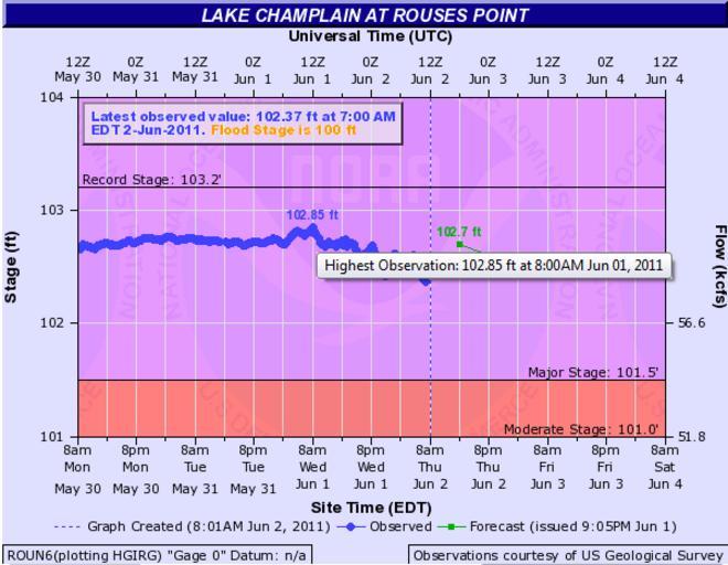
| Keywords: Lake Champlain Water Level at Rousse-Pointe(June-02-2011).png fr Graphique montrant le niveau du lac Champlain à Rouse Point Vermont Il montre que le niveau a dépassé le record de 102 1 pieds établi en 1869 La nouvelle cote 102 85 a été atteinte le 1er juin à 08 00AM EST 2011-06-02 http //water weather gov/ahps2/hydrograph php wfo btv gage roun6 view 1 1 1 1 1 1 1 1 toggles 10 7 8 2 9 15 6 US National Weather Service PD-USGov Uploaded with UploadWizard Lake Champlain Line charts | ||||