MAKE A MEME
View Large Image
| View Original: | LIRR_1891_Dunton_station.jpg (376x293) | |||
| Download: | Original | Medium | Small | Thumb |
| Courtesy of: | commons.wikimedia.org | More Like This | ||
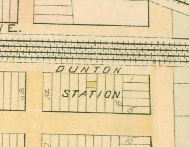
| Keywords: LIRR 1891 Dunton station.jpg This is a portion of an 1891 map of Queens New York United States showing Dunton station The map was scanned by the New York Public Library with Digital Image ID 1523088 The north-south streets are Baker Avenue and Van Wyck Avenue now 134th Street and the Van Wyck Expressway This is a crop of Image LIRR 1891 Morris Park facility jpg PD-art Artworks missing infobox template Old railroad maps of New York City Jamaica Queens Long Island Rail Road maps Former Long Island Rail Road stations in New York City | ||||