MAKE A MEME
View Large Image

| View Original: | Mao_Kun_map_-_Ceylon,_Africa.png (497x665) | |||
| Download: | Original | Medium | Small | Thumb |
| Courtesy of: | commons.wikimedia.org | More Like This | ||
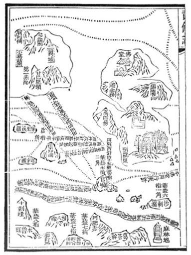
| Keywords: Mao Kun map - Ceylon, Africa.png en Mao Kun map showing Ceylon and east coast of Africa The main island to the right is Ceylon 錫è˜å±± India to the left Africa is shown at the bottom Malindi éº»æž—å ° indicated at the far right corner century 17 J V G Mills tr Ma Huan Ying-yai sheng-lan The overall survey of the ocean's shores Appendix 2 1970 Originally from the Wubei Zhi Treatise on Armament Technology a 17th century work with maps based on material dated to the early 15th century voyages of Zheng He Mao Yuanyi 1594 “1640 editor of the Wubei Zhi; and an unknown cartographer other versions PD-old-100 Uploaded with UploadWizard Mao Kun map Old maps of Sri Lanka Old maps of Africa | ||||