MAKE A MEME
View Large Image
| View Original: | Map of Ireland in 1609-es.GIF (466x582) | |||
| Download: | Original | Medium | Small | Thumb |
| Courtesy of: | commons.wikimedia.org | More Like This | ||
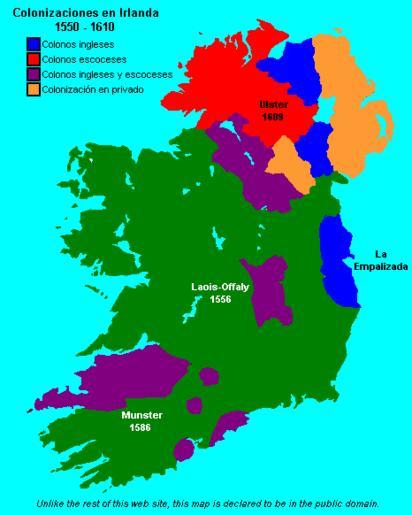
| Keywords: Map of Ireland in 1609-es.GIF Map of Ireland in 1609 showing the major Plantations of Ireland translated to Spanish Mapa de Irlanda en 1609 mostrando el proceso de colonización Map_of_Ireland_in_1609 gif 2008-12-23 14 14 UTC derivative work Edward the Confessor <span class signature-talk >talk</span> Map_of_Ireland_in_1609 gif www wesleyjohnston com Traslated to Spanish Edward the Confessor Map_of_Ireland_in_1609 gif http //www wesleyjohnston com/users/ireland/maps/historical/map1609 gif Upload 20</nowiki> Uploaded with derivativeFX Colonialism of the United Kingdom Maps of the history of Ireland Human migration | ||||