MAKE A MEME
View Large Image

| View Original: | Map of Lithuania and Poland c. 1400 (ru).svg (619x512) | |||
| Download: | Original | Medium | Small | Thumb |
| Courtesy of: | commons.wikimedia.org | More Like This | ||
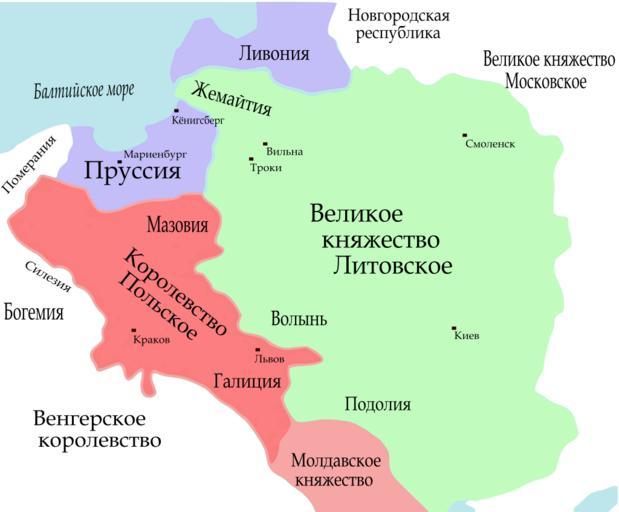
| Keywords: Map of Lithuania and Poland c. 1400 (ru).svg Map of Lithuania and Poland c 1400 Information taken mainly from the old German Map Image Poland under Jagello jpg plus a few locations from a map in the book The Times Concise Atlas of World History ISBN 0723006741 Map_of_Lithuania_and_Poland_c _1400 jpg 2010-08-25 17 35 UTC Map_of_Lithuania_and_Poland_c _1400 jpg Qp10qp derivative work Azgar <span class signature-talk >talk</span> Map of Lithuania and Poland c 1400 es svg Russian version Azgar Map_of_Lithuania_and_Poland_c _1400 jpg Maps of Grand Duchy of Lithuania Maps of the Kingdom of Poland Jagiellons SVG maps showing history in Russian | ||||