MAKE A MEME
View Large Image

| View Original: | MARTA Rail Map.svg (1017x1391) | |||
| Download: | Original | Medium | Small | Thumb |
| Courtesy of: | commons.wikimedia.org | More Like This | ||
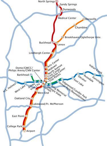
| Keywords: MARTA Rail Map.svg Map of the Metropolitan Atlanta Rapid Transit Authority's rail system Light blue lines represent major interstate and state highways Rail lines are orange North/South and dark blue East/West White circles represent the locations of train stations own Pedriana SVG maps of the United States Metropolitan Atlanta Rapid Transit Authority Rail transport in Atlanta Georgia Public transport maps of Atlanta | ||||