MAKE A MEME
View Large Image
| View Original: | Massies_Mill_Bridge,_II.jpg (5550x4350) | |||
| Download: | Original | Medium | Small | Thumb |
| Courtesy of: | www.flickr.com | More Like This | ||
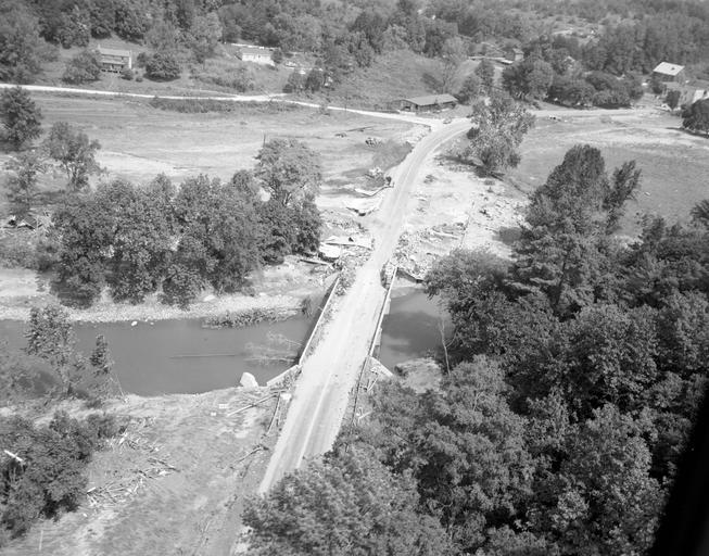
| Keywords: richmond va usa hurricane camille hurricanecamille flood flooding damage natural disaster naturaldisaster virginia richmond va usa virginiarichmondvausa blackandwhite monochrome outdoor black and white This aerial view shows the Rt. 56 bridge over the Tye River at Massies Mill, as well as surrounding homes that may have been damaged by flash flooding and mudslides. Located in Nelson County. No. 69-2251, Virginia Governor's Negative Collection, Library of Virginia. This aerial view shows the Rt. 56 bridge over the Tye River at Massies Mill, as well as surrounding homes that may have been damaged by flash flooding and mudslides. Located in Nelson County. No. 69-2251, Virginia Governor's Negative Collection, Library of Virginia. | ||||