MAKE A MEME
View Large Image
| View Original: | Meningitis-Epidemics-World-Map.png (2753x1400) | |||
| Download: | Original | Medium | Small | Thumb |
| Courtesy of: | commons.wikimedia.org | More Like This | ||
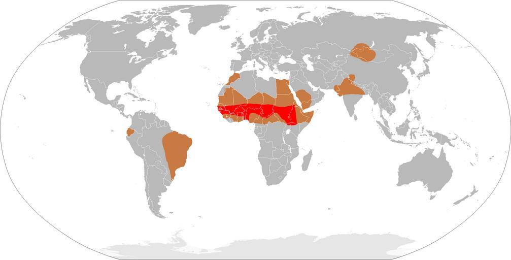
| Keywords: Meningitis-Epidemics-World-Map.png health map Derived from svg map en Image BlankMap-World3 svg which itself is derived from the CIA World Factbook Map of meningitis belt in red and regions of high risk of epidemics brown all other regions may have lower incidence of outbreaks and sporadic cases Regions sourced amalgamted from http //www chu-rouen fr/cap/meningo html CHU Rouens - MĂ©ningite http //www asnom org/fr/426_meningococcies html Association Amicale SantĂ© Navale et d'Outre-Mer and http //www cimed org/page asp id 23 CIMED - La Meningite Ă MĂ©ningocoque BlankMap-World-large png 2009-03-06 16 11 UTC User Leevanjackson <font color FF0000 size +1 > ™¦</font> Meningitis belt <font color E08040 size +1 > ™¦</font> epidemic zones <font color C0C0C0 size +1 > ™¦</font> sporadic cases Blank world maps </nowiki> Uploaded with derivativeFX Disease incidence world maps Meningitis | ||||