MAKE A MEME
View Large Image
| View Original: | MI_14th_congressional_district_(106th_Congress).PNG (575x425) | |||
| Download: | Original | Medium | Small | Thumb |
| Courtesy of: | commons.wikimedia.org | More Like This | ||
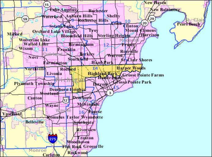
| Keywords: MI 14th congressional district (106th Congress).PNG Map of en Michigan's 14th congressional district for the en 106th United States Congress illustrating boundaries prior to redistricting in 2002 Source U S Census Bureau American Factfinder http //factfinder census gov/servlet/MapItDrawServlet geo_id 500 50000US2614 _bucket_id 50 tree_id 420 context AdvSearch _lang en PD-USGov original upload log page en wikipedia MI_14th_congressional_district_ 28106th_Congress 29 PNG 2007-07-22 14 27 Bkonrad 575×425× 44461 bytes <nowiki> Map of Michigan's 14th congressional district for the 106th United States Congress illustrating boundaries prior to redistricting in 2002 Source U S Census Bureau American Factfinder http //factfinder census gov/servlet/MapItDr</nowiki> Congressional district maps of Michigan 106 14 Congressional district maps of the 106th Congress Michigan 14 | ||||
.PNG)