MAKE A MEME
View Large Image

| View Original: | Mount Mazama eruption timeline 3.svg (1048x822) | |||
| Download: | Original | Medium | Small | Thumb |
| Courtesy of: | commons.wikimedia.org | More Like This | ||
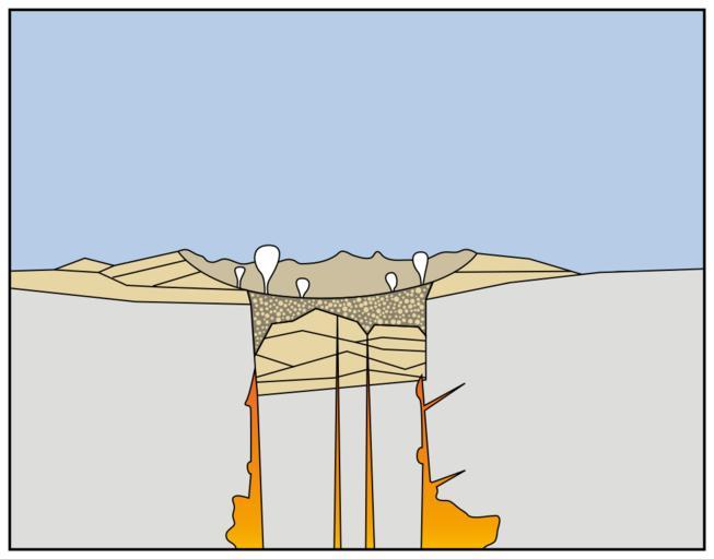
| Keywords: Mount Mazama eruption timeline 3.svg Eruptions of ash and pumice The cataclysmic eruption started from a vent on the northeast side of the volcano as a towering column of ash with pyroclastic flows spreading to the northeast Caldera collapse As more magma was erupted cracks opened up around the summit which began to collapse Fountains of pumice and ash surrounded the collapsing summit and pyroclastic flows raced down all sides of the volcano </span> Steam explosions When the dust had settled the new caldera was 5 miles 8 km in diameter and 1 mile 1 6 km deep Ground water interacted with hot deposits causing explosions of steam and ash <span style color cccccc; > Today In the first few hundred years after the cataclysmic eruption renewed eruptions built Wizard Island Merriam Cone and the central platform Water filled the new caldera to form the deepest lake in the United States Figure modified from diagrams on back of 1988 USGS map Crater Lake National Park and Vicinity Oregon </span> http //pubs usgs gov/fs/2002/fs092-02/ U S GEOLOGICAL SURVEY and the NATIONAL PARK SERVICE Nachgebaut von Benedikt Seidl 06-08-2008 Image Mount_Mazama_eruption_timeline PNG SVG Benedikt Seidl Mount_Mazama_eruption_timeline PNG Mount Mazama diagrams Volcanological diagrams Diagrams of calderas | ||||