MAKE A MEME
View Large Image
| View Original: | Mountain meadows map5.png (742x717) | |||
| Download: | Original | Medium | Small | Thumb |
| Courtesy of: | commons.wikimedia.org | More Like This | ||
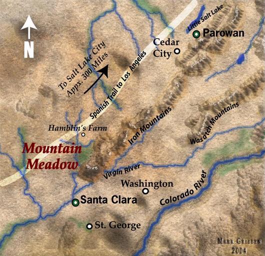
| Keywords: Mountain meadows map5.png Map of Southern Utah in 1857 highlighting the Mountain Meadows area including the Wasatch Mountains and Colorado River This is a cropped version of Image Mountain meadows map5 jpg in the more appropriate PNG format Note This map is not accurate although I can't speak to how effectively it locates the Hamblin house now a museum in Santa Clara or Mountain Meadows Washington St George and Santa Clara are all shown 10-20 miles east of their actual locations Notice that Santa Clara not St George is shown to be on the Virgin River I made this image myself Original was uploaded on 13 May 2005 Marklemagne Public domain 100px marklemagne Iron County Utah Jacob Hamblin Mountain Meadows massacre maps Maps of Utah Washington County Utah | ||||