MAKE A MEME
View Large Image

| View Original: | Netley1860map.jpg (5884x4645) | |||
| Download: | Original | Medium | Small | Thumb |
| Courtesy of: | commons.wikimedia.org | More Like This | ||
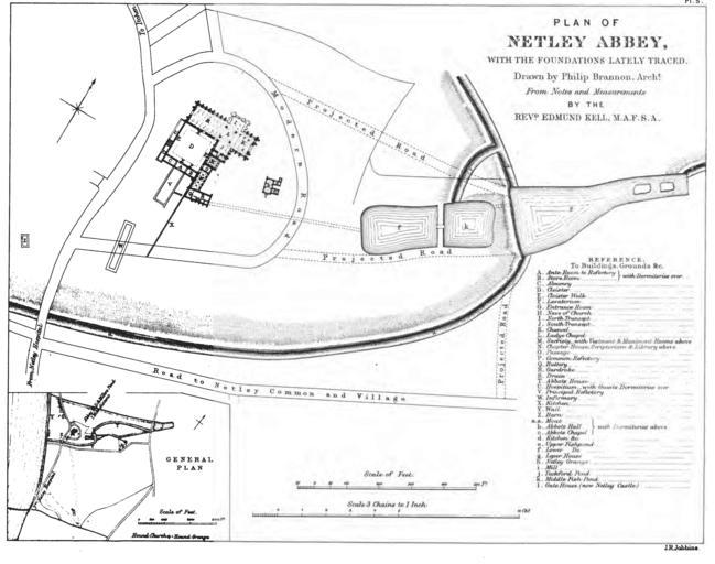
| Keywords: Netley1860map.jpg en Plan of the abbey and its precinct at the time of the 1860 excavations Of particular interest are the line of the moat and the three fishponds and the location of the two precinct buildings south of the abbey The area has been much built up since then and much of this evidence has disappeared beneath modern development Netley Abbey with an Account of Recent Excavations and Discoveries in Collectanea Archaeologica communications made to the British Archaeological Association Volume II Part i by Revd Edmund Kell Drawn by Phillip Brannon engraved by J R Jubbins 1863 PD-old Netley Abbey Maps of Hampshire | ||||