MAKE A MEME
View Large Image
| View Original: | Newfoundland1744Annotated.jpg (1284x776) | |||
| Download: | Original | Medium | Small | Thumb |
| Courtesy of: | commons.wikimedia.org | More Like This | ||
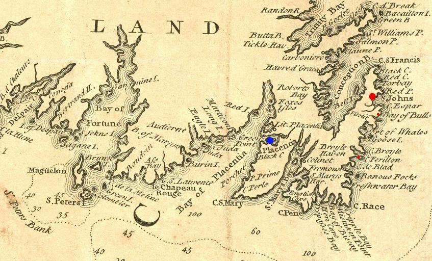
| Keywords: Newfoundland1744Annotated.jpg Extract from a 1746 map depicting southeastern Newfoundland In addition to crop for selection image has had levels and colors adjusted to improve contrast and has been annotated to show a few places of importance in Queen Anne's War Plaisance is marked in blue St John's is marked with a large red spot and Ferryland and B Boston Public Library Norman Leventhal Map Center http //maps bpl org/details_14079/ 1746 Jacques Bellin; annotations by User Magicpiano File Newfoundland1744 jpg Norman Leventhal Center Old maps of Newfoundland History of Newfoundland and Labrador Old maps of Canada Old maps of Saint-Pierre and Miquelon War of the Spanish Succession PD-US | ||||