MAKE A MEME
View Large Image

| View Original: | NGMDB_databases_linked_together.jpg (600x301) | |||
| Download: | Original | Medium | Small | Thumb |
| Courtesy of: | commons.wikimedia.org | More Like This | ||
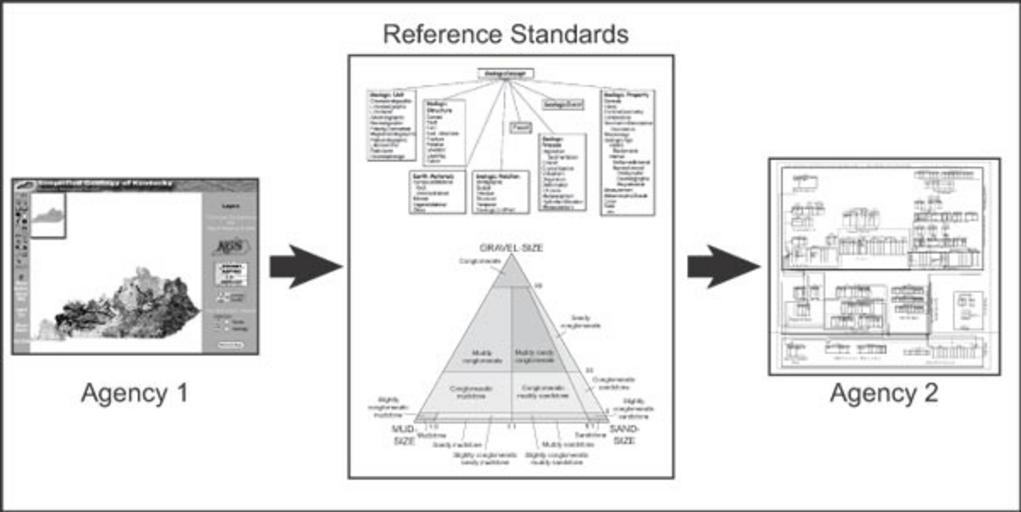
| Keywords: NGMDB databases linked together.jpg en Figure 12 A single monolithic system design shared by all agencies is unlikely Rather interoperability among the many agency databases linked together by the NGMDB database is the most logical design philosophy In this diagram we envision that map data from one agency the Kentucky Geological Survey http //www uky edu/KGS/ will be translated into reference standards the data model and science language standards adopted by the NGMDB and translated out to the criteria required by another agency the Idaho Geological Survey ™s Geologic Map Data Model http //www idahogeology org/Lab/datamodel htm This approach also could permit the NGMDB to coordinate the translation and display of multiple agency databases In this diagram the reference standards are represented by a schematic of the draft NGMDB data model discussed in another paper in this volume and an example of science language from Folk 1954 fig 1a showing a rock classification based on mud-sand-gravel content http //pubs usgs gov/of/2003/of03-471/soller1/index html The National Geologic Map Database Project Overview and Progress U S Geological Survey Open-File Report 03 “471 David R Soller1 and Thomas M Berg 2003 PD-USGov Data model GIS National Geologic Map Database Project | ||||