MAKE A MEME
View Large Image
| View Original: | NOAA_Weather_Radio_WNG575_Coverage_Map.png (725x996) | |||
| Download: | Original | Medium | Small | Thumb |
| Courtesy of: | commons.wikimedia.org | More Like This | ||
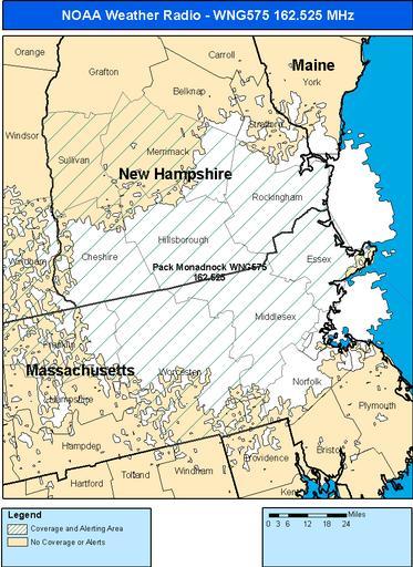
| Keywords: NOAA Weather Radio WNG575 Coverage Map.png en A map of the NOAA Weather Radio Station Pack Monadnock NH WNG575's coverage area 2011-08-18 http //www weather gov/nwr/Maps/PHP/site php State MA Site WNG575 NOAA's National Weather Service NOAA is a jurisdiction of the Federal gov't of the United States PD-USGov Uploaded with UploadWizard NOAA Weather Radio coverage maps Maps of New Hampshire Maps of Massachusetts | ||||