MAKE A MEME
View Large Image

| View Original: | Nordaustlandet labelled.png (524x528) | |||
| Download: | Original | Medium | Small | Thumb |
| Courtesy of: | commons.wikimedia.org | More Like This | ||
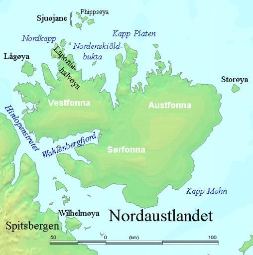
| Keywords: Nordaustlandet labelled.png en Map detailing the marine features of Spitsbergen in the Svalbard archipelago Settlements and mountains are indicated and labelled See also Image Spitsbergen mountains and marine features labelled png Locations were labelled mainly based on detailed maps from http //www svalbard-images com/spitzberg/spitzberg-sud php svalbard-images com sample of south Spitsbergen linked cross-referenced with other map sources where possible http //miljo npolar no/placenames/pages/detaile asp placeNameID 615073M Norwegian Polar Institute figures were used for mountain names and heights which are given in meters above sea level 2006-07-29 own assumed TheGrappler http //www demis nl/home/pages/wms/demiswms htm DEMIS World Map Server generated this map from Public Domain sources DEMIS does not claim any rights over the resultant image http //www2 demis nl/mapserver/DataSrc htm Alterations including the addition of settlements and captions were performed on 24 July 2006 by User TheGrappler the uploader who releases all associated rights PD-Demis derivative works Wilhelmøya PNG Maps of Svalbard Nordaustlandet Sjuøyane Austfonna | ||||