MAKE A MEME
View Large Image
| View Original: | Omgeving_Charleville-Mézières_1920.jpg (6129x3527) | |||
| Download: | Original | Medium | Small | Thumb |
| Courtesy of: | commons.wikimedia.org | More Like This | ||
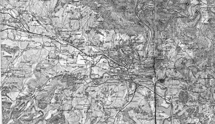
| Keywords: Omgeving Charleville-Mézières 1920.jpg en Picture taken of part of the map In particular the area around Charleville-Mézières This map shows the the main railways and the metric railways of the CFDA Chemins de fer départementaux des Ardennes From Mohon and Nouzon French military staf map of the area around Mézieres French military map department between 1910 1924 Omgeving Charleville-Mézières 1920 CFDA jpg Narrow gauge railways in France Local railway maps of France History of Charleville-Mézières Old maps of Ardennes department PD-old | ||||