MAKE A MEME
View Large Image
| View Original: | Paklung413.jpg (1361x888) | |||
| Download: | Original | Medium | Small | Thumb |
| Courtesy of: | commons.wikimedia.org | More Like This | ||
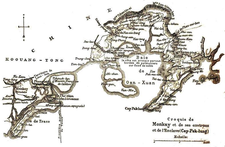
| Keywords: Paklung413.jpg Khu v沼켧 c沼춁 s척ng B梳칌 Lu창n b찼n 휃梳즣 B梳죅h Long v횪 c찼c l횪ng ng튼沼 i Kinh t梳죍 V梳죒 M칫 nay thu沼셛 Trung Qu沼멵 P Neis 1888 Sur les frontieres du Tonkin Bulletin de la Societe de Geographie de I'Est 1 trang 413 1888 P Neis Other versions PD-old from vi T梳춑 tin Paklung413 jpg ImageNote 1 846 453 340 247 1361 888 2 Bailongwei peninsula Fangchenggang Guangxi ImageNoteEnd 1 Check categories 2010 August 15 en wikipedia B梳죅h_Long_V칫 11 River deltas Geography of Guangxi Maps of Hainan Red River Asia Geography of Guangdong Islands of Vietnam Gulf of Tonkin History of Haiphong Maps of Haiphong 휂척ng B梳칌 Region maps | ||||