MAKE A MEME
View Large Image
| View Original: | PANTHER_CREEK_RISES=Schuylkill_Drainage_Divides_USGS,_Hazelton-Mauch_Chunk_&Mountain_Quads,NW+NE-4.JPG (813x370) | |||
| Download: | Original | Medium | Small | Thumb |
| Courtesy of: | commons.wikimedia.org | More Like This | ||
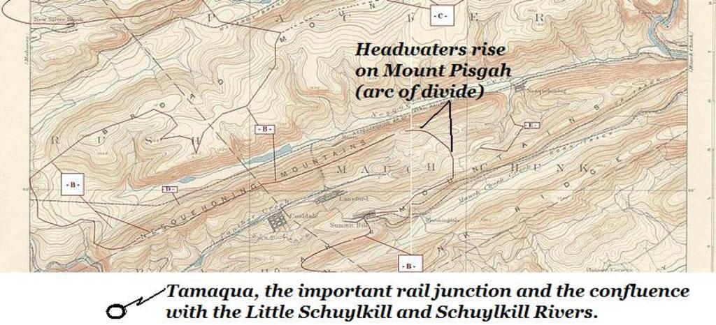
| Keywords: PANTHER CREEK RISES=Schuylkill Drainage Divides USGS, Hazelton-Mauch Chunk &Mountain Quads,NW+NE-4.JPG Panther Creek in Northeastern Pennsylvania from it's rising on Mount Pisgah Carbon County Pennsylvania Mount Pisgah above but on the opposite slope from both Nesquehoning Pennsylvania and Jim Thorpe Pennsylvania Jim Thorpe PA thence running westerly between Pisgah Ridge south and Nesquehoning Ridge north ridgeline to it's confluence in Tamaqua Pennsylvania just off the map to the lower left with the Little Schuylkill River and its nearly co-located confluence with the Schuylkill River 2013-10-03 20 30 38 USGS _Hazelton Quadrant 1893 survey USGS as adapted by <B>Fra</B><font color green >nkB</font> PD-USGov Uploaded with UploadWizard Rivers of Pennsylvania Carbon County Pennsylvania Schuylkill County Pennsylvania Northeastern Pennsylvania Topomaps USGS MRC40075-series of corners N40xW75 to N41xW76 Tamaqua Pennsylvania Nesquehoning Pennsylvania Lansford Pennsylvania Maps of rivers of Pennsylvania Jim Thorpe Pennsylvania | ||||