MAKE A MEME
View Large Image
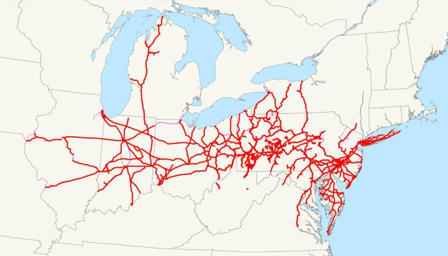
| View Original: | Pennsylvania Railroad system map (1918).svg (1119x640) | |||
| Download: | Original | Medium | Small | Thumb |
| Courtesy of: | commons.wikimedia.org | More Like This | ||
| Keywords: Pennsylvania Railroad system map (1918).svg This is a map of the Pennsylvania Railroad system as of 1918 with trackage rights in purple and future lines dotted The two disconnected pieces in West Virginia are not an error; they are remaining portions of the Little Kanawha Syndicate properties that were partially controlled by the PRR-owned Pennsylvania Company Email me if you would like a copy of the GIS data I created modified from Bureau of Transportation Statistics North American Transportation Atlas Data or if you see any errors 2009-03-18 own assumed NE2 Maps of the Pennsylvania Railroad | ||||
.svg)