MAKE A MEME
View Large Image
| View Original: | Photograph_of_800_Foot_Long_Gully_in_an_Abandoned_Field_-_NARA_-_2128694.jpg (986x635) | |||
| Download: | Original | Medium | Small | Thumb |
| Courtesy of: | commons.wikimedia.org | More Like This | ||
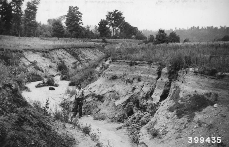
| Keywords: Photograph of 800 Foot Long Gully in an Abandoned Field - NARA - 2128694.jpg Scope and content Original caption 800' long gully in abandoned field Em soil Slope 5 Sec 30-23-10 General notes 2128694 Local identifier 399435 Department of Agriculture Forest Service Region 9 Eastern Region 1965 - Most Recent <br /> Department of Agriculture Division of Forestry 1881 - 07/01/1901 Predecessor NARA-Place Huron-Manistee National Forests Mich 4509455 <br /> NARA's Great Lakes Region Chicago NRDA 7358 South Pulaski Road Chicago IL 60629-5898 08/1940 Record group Record Group 95 Records of the Forest Service 1870 - 2008 Record group ARC 424 Historic Photographs compiled ca 1880 - ca 1970 Series ARC 1812856 File unit File unit ARC Variant control numbers Agency-Assigned Identifier 399435 Other versions <gallery> File Photograph_of_800_Foot_Long_Gully_in_an_Abandoned_Field_-_NARA_-_2128694 tif tif File Photograph_of_800_Foot_Long_Gully_in_an_Abandoned_Field_-_NARA_-_2128694 jpg jpg </gallery> NARA-cooperation PD-USGov Erosion channels Geography of Michigan Huron-Manistee National Forests August 1940 in Michigan NARA images of Michigan Black and white photographs of Michigan | ||||