MAKE A MEME
View Large Image

| View Original: | Plan_ft_st_philip.jpg (600x679) | |||
| Download: | Original | Medium | Small | Thumb |
| Courtesy of: | commons.wikimedia.org | More Like This | ||
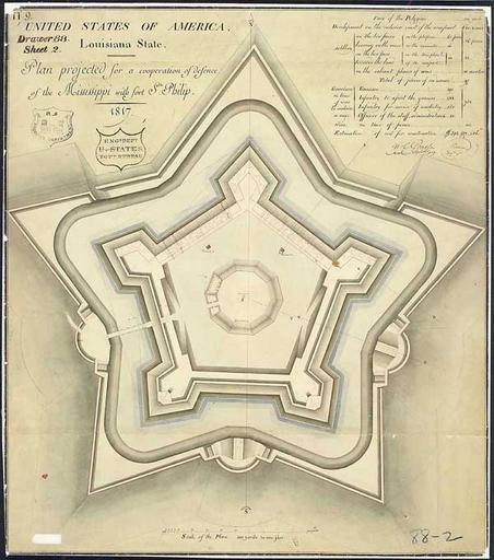
| Keywords: Plan ft st philip.jpg Plan Projected for a Cooperation of Defense of the Mississippi with Ft St Philip Drawn by cartographer and draftsman Guillaume Tell Poussin 1817 Ink and wash on paper This planned fort to work in cooperation with the existing colonial era Fort St Phillip on the East Bank of the Mississippi River in what is now Plaquemines Parish Louisiana was constructed starting in 1822 on the West Bank of the Mississippi and named Fort Jackson http //www archives gov/exhibits/designs_for_democracy/symbols_and_substance/articles/plan_ft_st_philip html source Image previously uploaded to en Wikipedia 12 59 17 September 2005 by en User Darwinek PD-USGov 1817 maps Fort Jackson Louisiana Guillaume Tell Poussin | ||||