MAKE A MEME
View Large Image
| View Original: | Plan_New_Orleans_1803_Boquet_de_Woiseri_Detail.jpg (1024x312) | |||
| Download: | Original | Medium | Small | Thumb |
| Courtesy of: | commons.wikimedia.org | More Like This | ||
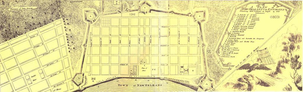
| Keywords: Plan New Orleans 1803 Boquet de Woiseri Detail.jpg 1803 map A Plan of New Orleans its Environs detail showing French Quarter and Faubourg St Marie now part of the Central Business District Map by John L Boqueta de Woiseri via reprint in Atlas of the Historical Geography of the United States 1932 note- republication did not reprint entire map via scan at http //www flickr com/photos/cartoko/4492986161/in/set-72157623684246608/ 1803 John L Boqueta de Woiseri mapmaker PD-old-100 Full map at lower resolution File PlanNewOrleansBoquetadeWoiseri jpg 1803 maps old maps of New Orleans 1803 in New Orleans J L Bouqueto de Woiseri | ||||