MAKE A MEME
View Large Image
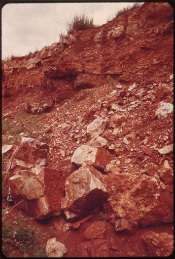
| View Original: | RED_CLAY_SOIL_CAUSES_MUCH_OF_THE_SILTATION_PROBLEM_IN_THE_LAKE_OF_THE_OZARKS_REGION._ALONG_ROUTE_54,_SOUTHWEST_OF..._-_NARA_-_551233.jpg (2020x3000) | |||
| Download: | Original | Medium | Small | Thumb |
| Courtesy of: | commons.wikimedia.org | More Like This | ||
| Keywords: RED CLAY SOIL CAUSES MUCH OF THE SILTATION PROBLEM IN THE LAKE OF THE OZARKS REGION. ALONG ROUTE 54, SOUTHWEST OF... - NARA - 551233.jpg Scope and content General notes 551233 Local identifier 412-DA-8748 Environmental Protection Agency 12/02/1970 - NARA-Author Kuykendall Bill Photographer 2708009 <br /> Lake of the Ozarks State Park Missouri United States North and Central America state park 3251098 38 083 -92 617 <br /> Still Picture Records Section Special Media Archives Services Division NWCS-S National Archives at College Park 8601 Adelphi Road College Park MD 20740-6001 06/1973 Record group Record Group 412 Records of the Environmental Protection Agency 1944 - 2006 Record group ARC 708 DOCUMERICA The Environmental Protection Agency's Program to Photographically Document Subjects of Environmental Concern compiled 1972 - 1977 Series ARC 542493 File unit File unit ARC Variant control numbers Agency-Assigned Identifier 146/48/008748<br /> NAIL Control Number NWDNS-412-DA-8748 Other versions <gallery> File RED_CLAY_SOIL_CAUSES_MUCH_OF_THE_SILTATION_PROBLEM_IN_THE_LAKE_OF_THE_OZARKS_REGION _ALONG_ROUTE_54 _SOUTHWEST_OF _-_NARA_-_551233 tif tif File RED_CLAY_SOIL_CAUSES_MUCH_OF_THE_SILTATION_PROBLEM_IN_THE_LAKE_OF_THE_OZARKS_REGION _ALONG_ROUTE_54 _SOUTHWEST_OF _-_NARA_-_551233 jpg jpg </gallery> NARA-cooperation PD-USGov Lake of the Ozarks State Park | ||||