MAKE A MEME
View Large Image
| View Original: | Regions of Georgia (U.S. state).png (500x579) | |||
| Download: | Original | Medium | Small | Thumb |
| Courtesy of: | commons.wikimedia.org | More Like This | ||
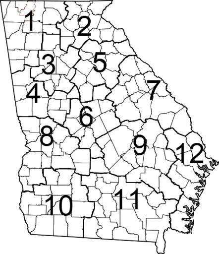
| Keywords: Regions of Georgia (U.S. state).png This is a map showing the 12 regions the state of Georgia is divided into for state government purposes Map_of_Georgia_highlighting_Whitfield_County svg 2011-11-22 13 48 UTC Map_of_Georgia_highlighting_Whitfield_County svg David Benbennick derivative work ucfirst Presidentman · Wikipedia Random Picture of the Day Removed red fill added back lines numbers Presidentman Map_of_Georgia_highlighting_Whitfield_County svg </nowiki> Uploaded with derivativeFX Uncategorized 2015 March 29 | ||||
.png)