MAKE A MEME
View Large Image
| View Original: | Reichsstadt Ulm 1789.png (668x386) | |||
| Download: | Original | Medium | Small | Thumb |
| Courtesy of: | commons.wikimedia.org | More Like This | ||
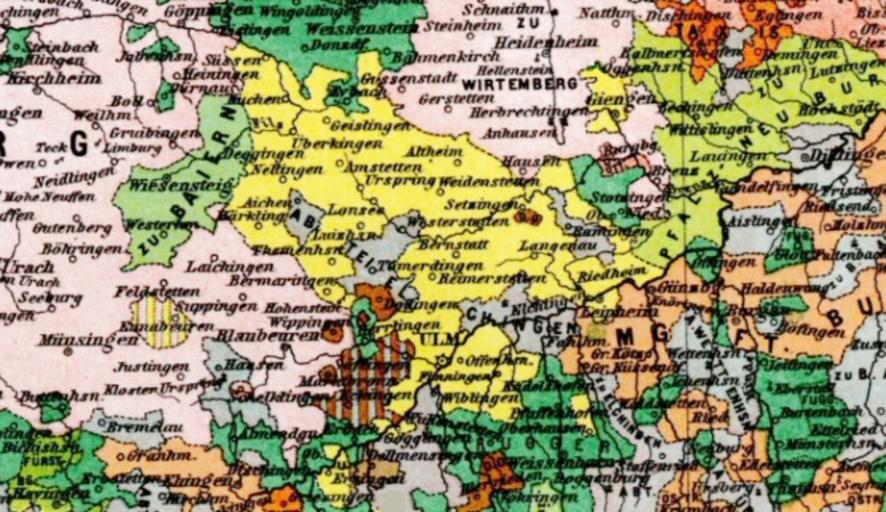
| Keywords: Reichsstadt Ulm 1789.png en Territory of the Free Imperial City of Ulm in the late 18th century in yellow Also shown in the upper right section is the smaller Imperial City of Giengen also in yellow <br> On the map the areas in steel blue color crisscrossing the southern part of the territory of Ulm belonged to the Imperial Abbey of Elchingen Other patches in the same color belonged to other ecclesiastical states such as the Imperial Abbey of Wettenhausen Much of the area north and west of Ulm belonged to Württemberg Cropped from a historical map showing Southwestern Germany and Alsace in 1789 by Karl Spruner and Theodor Menke 1880 1880 Hand-Atlas für die Geschichte des Mittelalters und die neueren Zeit Spuner Menke Atlas 1880 other versions PD-old-70 Historical maps of Ulm | ||||