MAKE A MEME
View Large Image

| View Original: | Rheinkarte.JPG (3055x3099) | |||
| Download: | Original | Medium | Small | Thumb |
| Courtesy of: | commons.wikimedia.org | More Like This | ||
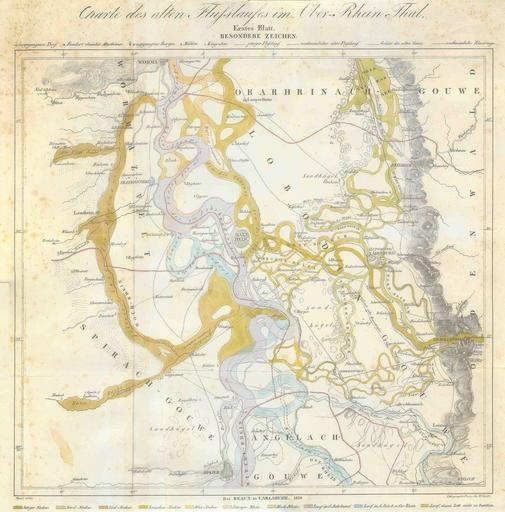
| Keywords: Rheinkarte.JPG en Historic map of different riverbeds of Rhine and Neckar from the 6th century until 1850 de Historische Landkarte alter Flussläufe von Rhein und Neckar vom 6 Jahrhundert bis 1850 von Speyer und Heidelberg bis Worms Originaltitel Charte des alten Flußlaufes im Ober-Rhein-Thal Legende auch ganz unten auf der Karte die Farbabstufungen sind nicht 100 ig wiederzuerkennen aber die Karte ist gut beschriftet Hellblau Lauf im 6 Jahrhundert und Ost-Rhein Helles Lila Lauf im 8 Jahrhundert Dunkelbraun Hoch-Rhein Hellbraun Jetziger Rhein also 1850 Grasgrün Zwischenneckar Grün-Braun Süd-Neckar Hellgrün Nord-Neckar Dunkelgrün Jetziger Neckar also 1850 published by BRAUN in Karlsruhe Litographirt von Jos Wehrte Originaltext 1850 This map is stitched together from 4 scans I made in 2004 I just found on my harddrive Also my orginal back then actually was a color copy that again was stitched together from 2 parts Thus it might suffer from a lack of quality However I have never seen any other map showing these different riverbeds so well If you have a real original feel free to replace this 49 30 0 N 8 25 0 E Altrhein Maps of the German Confederation Rhein-Pfalz-Kreis Old maps of Baden-Württemberg Old maps of Rhineland-Palatinate Old maps of Hesse Maps of Neckar Maps of Mannheim 1850 1850 in Germany Maps of the history of the Rhine PD-old | ||||