MAKE A MEME
View Large Image
| View Original: | Rio_Colorado_of_the_West_1858.jpg (10701x4739) | |||
| Download: | Original | Medium | Small | Thumb |
| Courtesy of: | commons.wikimedia.org | More Like This | ||
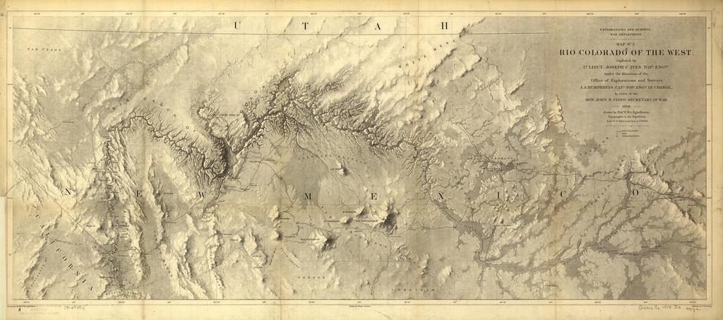
| Keywords: Rio Colorado of the West 1858.jpg Rio Colorado of the West / explored by 1st Lieut Joseph C Ives Topl Engrs under the direction of the Office of Explorations and Surveys A A Humphreys Capt Topl Engrs in charge by order of the Hon John B Floyd Secretary of War; drawn by Frhr F W v Egloffstein topographer to the expedition Published as Explorations and Surveys War Department map no 2 1858 Shows the Colorado River and vicinity with the Grand Canyon towards the middle The map covers approximately the northern half and full width of present-day Arizona Relief shown by shading and hachures Also shows routes of exploration Scale 1 760 320 Digital version produced by the U S Library of Congress Geography and Map Division JPEG 2000 source image converted to JPEG by User Delirium using http //www ece uvic ca/~mdadams/jasper/ JasPer 1 701 0 since JPEG 2000 is not as of this uploading supported on Commons LOC-map g4302c np000062 Old maps of the United States Maps of the Grand Canyon Old maps of Arizona 1858 maps PD-USGov | ||||