MAKE A MEME
View Large Image
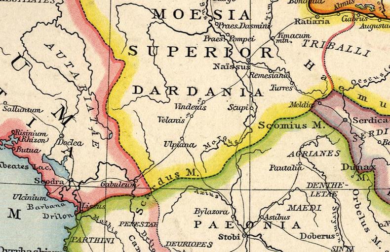
| View Original: | Roman_Dardania_(detail),_Droysens_Historical_Atlas,_1886.jpg (886x574) | |||
| Download: | Original | Medium | Small | Thumb |
| Courtesy of: | commons.wikimedia.org | More Like This | ||
| Keywords: Roman Dardania (detail), Droysens Historical Atlas, 1886.jpg Dardania inside the Roman province of Moesia Superior part of Old historical map from Droysens Historical Atlas 1886 Gustav Droysens Allgemeiner historischer Handatlas in 96 Karten mit erläuterndem Text Bielefeld u a Velhagen Klasing 1886 S 16 2010-01-29 Gustav Droysens PD-old RomanDardaniaMoesiaSuperior1 png This file derives from thumb Old maps of the Balkans 1886 Maps of the Danube watercourse system All Johann Gustav Droysen Maps of Illyricum Maps of the history of Kosovo in ancient times Moesia Superior Inferior Maps of Dacian tribes Dardania Roman Empire | ||||
,_Droysens_Historical_Atlas,_1886.jpg)